Posts

Showing posts from June, 2024

Brooks Range Travel Day: All Done

Image
Coastal Mountains from the flight to Seattle Huh. Well, I'm on a plane to Seattle looking down on some spectacular Yukon and SE Alaskan glaciers. Now *those* are mountains! (I kid, I kid, all mountains are glorious in the sight of (non-existent) God.) But seriously, how on Earth do you do any sort of human-powered travel down there? Anyway, my first trip to the Brooks is over. I carried as much food as I could fit in two bear cans (well, one Ursack and one can) and I pretty much ate it all, so I'm going home.  I woke up, walked the 4 miles of ATV track and gravel road to the village. Walking by the village dump was a bit of a downer, but I checked in with Amy about hopping on a Wright Air flight home, and then had a nice chat with Ranger Al about the park, the village, federal employment, etc. He's a wealth of knowledge, having been a seasonal NPS employee (the only one in Anaktuvuk Pass) for 18 years. He answered all the questions I posed in my previous post--basically yes...

Brooks Range Day 11: Confusion Kersplatt

Image
Oof. Got an enjoyable late start and descended Confusion Creek. I decided I wanted to try and make the loop a tiny bit longer and get a bit more of the "there's nothing left to the north but the Arctic" views, so I climbed up on a ridge. It was a nice moment, except marred by the fact that I was at least a mile away from where I thought I was (my guess before I turned on GPS). I was well further north, off the good base layer maps that I downloaded, and outside of Gates of the Arctic National Park. Not problem, really, even a bit neat. Except these unforced errors became a bit of a pattern. I descended back to Confusion Creek and climbed up a ridge to get to Skimo Creek. It was a dry creek bed full of dry rocks, which felt rare and interesting, since every single drainage on the trip, and plenty of non-drainages too, have been full of water. Eventually some running water surfaced in the creek, then went back under, and I stepped on a large flat boulder and thought "o...

Brooks Range Day 10: Solo on Confusion Creek

Image
Got a nice long restful sleep. But I was bummed to realize when packing up that I really truly have only three days of food left, and the store, which isn't too great to resupply from anyway, is closed today (Sunday). Guess I'm finishing midday Tuesday! I set out on my solo loop up Contact Creek and down Confusion Creek. I checked in with Amy one last time (the Starlink connection was still open) and asked her to move up my Wright Air Services flight back to Fairbanks so that I (a) won't be starving and bored and (b) so that I won't smell awful on my Thursday afternoon flight from Fairbanks to Reno. I saw some folks headed towards the ranger station and started up a conversation, turns out they were the researchers we saw yesterday, and they were doing bird counting. I tried to ID the most common bird I've heard so far by its call, his best guess was tree swallow (ironic because there are no trees here). I finally got moving and headed out of town up Contact Creek. ...

Brooks Range Day 9: Back to Anaktuvuk Pass

Image
Perfect time to start a hike Very cold, though Hit by the sun at 2:46AM Done with the loop around 5AM Off goes Nano Woke up at 11:30 PM and starting hiking under the midnight sun. Unfortunately the sun was behind a mountain until 2:30 AM even if it was technically above the horizon and plenty light out. Also, it was very cold. The first few creek crossings were painful, and we avoided crossing the main river nearly at all cost. Eventually after an hour or two it became not-the-worst, but still pretty annoying, and after maybe three hours, immediately after an obnoxiously deep and unsurpassable duck pond that we had to go around, we found the ATV trail we were pretty sure would exist closer to the village. We walked 5 miles of that, sometimes awful and boggy, sometimes halfway decent, and the village was in view. We saw a few researchers outside the village (found out later they were doing a bird count for NPS) and strolled across the airstrip in town a few minutes after 5 AM. Anaktuvuk...

Brooks Range Day 8

Image
Big day. We woke up below the pass and as usual, walked by plenty of nice dry camping spots further along the way. We descended the drainage and joined the Tinayguk River, which we'd heard might be big and powerful. It wasn't really an issue since we were so close to eh headwaters, but we had to follow it 10+ miles and pass lots of feeders. It didn't really have much of a gravel bar to it, and the rocks were slippery as snot, so I didn't like crossing it. We stayed on the left side for a while, first on a bench, then on good moose trail. We eventually switched over to river right, climbed onto a ledge and just shwacked and shwacked and shwacked. Sometimes the game trails were good, sometimes they weren't.  So after maybe 12 miles of mostly shwacking, we crossed over into our next drainage and climbed up to the pass above Inukpasagruk Creek. I underestimated how long it would take, but it was far less crappy rock than many other climbs. A nice frozen lake greeted us ...

Brooks Range Day 7

Image
Two-Pass Day, starting with Peregrine Loving the views at the top These flowers indicate good, non-boggy, walking Kicking steps up Horseshit Pass Happy to be at the top Has it really only been a week out here? It feels like at least a month. Been great not being glued to my phone (except for photos, looking at the map, and doing these nightly updates). I thought of this big thing of national importance happening in November for the first time of the trip today.  Anywho, we left our surrounded-by-bogs spot and were pretty much immediately on more solid ground. We climbed up and up the North Fork of the Koyukuk and then straight up to Peregrine Pass, or rather, just south of it on the map, the place that actually makes sense to cross. The views were spectacular, and the descent was a ton of fun, just a nice slightly slippery field of small pieces of slate, I even ran a bit of it. We had been thinking about going separate ways back to Anaktuvuk Pass (one over Ernie's Pass and back the...

Brooks Range Day 6

Image
We skirted a lot of creek edges like this But it didn't always go, somtimes you just had to climb up up up to get out We popped out into this wonderland River ice is good walking, way nicer than unconsolidated slope snow Woke up late after a night spent coughing nonstop. We descended Alinement Creek, which wasn't so bad. The crossings weren't super deep, maybe a fast one or two, and we could often skirt the edge of the side we were already on to avoid crossing. Eventually we climbed up across a hill connecting it to our next drainage, the North Fork Koyukuk. We stopped for lunch, but Nano has to get water so he descended to the Koyukuk and I stayed on a bluff enjoying the views of big mountains, possibly Wien Mountain and Mount Doonerak. And then there were three wolf puppies playing with each other maybe thirty yards away from me. I go a good look at them through the monocular. So cute. Unfortunately in my attempt to get Nano's attention I scared them away, so I didn...

Brooks Range Day 5

Image
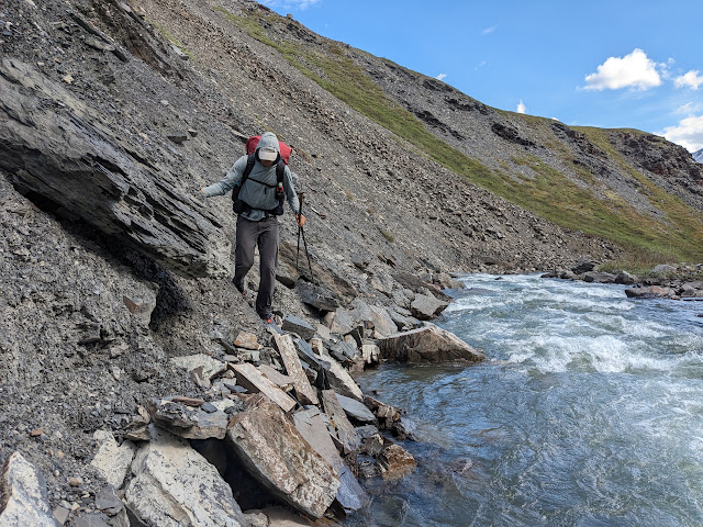
Oh boy. I woke up early after a fitful night of trucks going by on the highway. We made great time heading back up to our route, the out and back resupply section went much faster, as we stumbled on a game trail high above the north side of the creek we had to cross 10 or so times yesterday on the way in. The climb up from there and the descent down the other side were also easier--we stayed out of the creek and luckily the terrain wasn't too brushy or boggy. When we got to Kuyuktuvuk Creek that all changed. The crossing were all above the knees on me, fairly swift, and uncountably large in number. We'd occasionally go around but it was quite brushy. Finally around lunch time after the umpteenth sketchy crossing we bushwhacked our way to an unnamed tributary, and then bushwhacked we'll above it for a couple miles since it was a narrow rager. There were occasional game trails, but I only gave them a C- grade. It was actually kind of hot, but thankfully there weren't many...

Brooks Range Day 4

Image
The best way to climb was in the creek Lunch at the Pass Ben, very much from Chicago, riding his bike from Deadhorse south to freedom The pipeline has a few pit toilets. A bus company will drop your bearcan there for $25. Proof that I've seen the pipeline Short hard day. A little bit of descent down the creek and then a brushy climb up to the pass. It was easiest to just stay in the creek.  Then down a nice grassy slope until another creek headed to the highway that was more of a canyon with multiple nearly waist-deep crossings back and forth. Did I mention it was raining? Finally made it out, crossed the Dietrich, and hit the highway. Still raining, a fair amount of truck traffic going by. Didn't know quite where our resupply packages would be, so go a little worried, but they were right behind the outhouse just after milepost 235. Very relieved they were there. Right as we walked up Ben from Chicago rolled down the hill from the pass on his bike. Apparently Alaska Airlines fl...

Brooks Range Day Three

Image
Didn't get started till a little later but it was gorgeous. Continued descending down no-name river with crazy peaks to our north until it met the Itkillik River. Before it did that it flowed out into the valley, we crossed it for the last time just before the basin grew full of ice, and we walked on the ice as far as it would take us. We crossed the Itkillik low in the valley, then climbed to its source and crossed over the divide to the south. There was a bit of snow (and another two campers) near the pass but it was nothing near as bad as yesterday. We kept going till late, 9:30 or so, to make sure we were over the pass. Crappy weather is supposed to come in tomorrow.   Itkillik River Lake at Pass on the Divide  

Brooks Range Day Two

Image
Woke up and crossed a cold river. Ascended, and ran into a couple out on a month long adventure. They'd just bagged a cool looking peak the day before, which instantly made Nano want to do it; I wanted to get a little more comfortable that our pace is sufficient first. Anyway, crested one pass, then contoured a bit and there was a ton of snow that was totally, totally rotten. We were sinking up to our hips, sometimes I'd crawl on all fours to try and spread my weight out better. It was awful. Finally we reached a creek coming out of another drainage, a huge cirque, and we had to climb up the opposite wall. There were two waterfalls that had relatively easy gravel to get there, but looked sketchy once you were at the waterfall. I suggested we do a little more snow, and go to the right of the rock wall directly above us. Part way up we realized the rock was two rock walls and there might be a chute between them that goes. Thank God there was. The rock on the chute was pure shit, ...

Brooks Range Day One

Image
Flying from Fairbanks to the village ATV hunting trail out the big river to a wide, icy crossing Home in the village: ATVs and a trampoline   Thank goodness my new tent is easy to set up, because I'm generally out of practice at this. It started raining pretty heavily about two minutes after I finally relented and we stopped for the day at 8:15pm or so. Still bright as noon, and we did 20 miles in 9 hours, which has got to be pretty good time for the Brooks Range, except we were on an ATV trail basically the entire day. Woke up around 5 or 6, repacked my bag, and got an Uber to the local side of the airport (Wrights Air Service) by 7:30. Our flight left around 9, clear skies the whole way. Upon arrival we got our stuff, talked to the NPS Ranger for a bit, and he told us how to get out of town, and that the ATV trail was on the north side of the river (otherwise we probably wouldn't have bothered crossing since we don't need to, but the walking in definitely better). Walked ...

inReach message from Garret Christensen

I'm starting my trip. Garret Christensen sent this message from: Lat 64.808661 Lon -147.852137 Do not reply directly to this message. This message was sent to you using the inReach two-way satellite communicator with GPS. To learn more, visit http://explore.garmin.com/inreach .

Scout Mountain 100

Image
I just got back from running Scout Mountain 100, my 33rd complete 100-or-more mile race, outside Pocatello, Idaho. I also got to visit with a couple Utah friends since I flew through SLC, so it was a nice weekend. I'd say it's a good, tough course. It was unfortunately very hot (high of 89 in Pocatello Friday, 88 Saturday) and coming relatively early in the season that made the heat feel even worse, likely skewing my view of things. Endless field of mule's ears  The course has three major climbs and several additional smaller ones for 22K vert. Two of the big climbs take you to 8500'+ summits (Old Tom and the eponymous Scout Mountain) which had great views and still had a little snow on them, necessitating some fun glissades on Scout. Views are often open in other places even if you're in foothills rather than alpine terrain.  First Summit, Old Tom Friendly guy (whose name I hope is Tom) with big dogs on summit of Old Tom   The trails were in decent, if not wonderfu...